Open House

Summer 2017

The design of the Division Transit Project has progressed over the last six months, and this online open house lets you explore the current design.

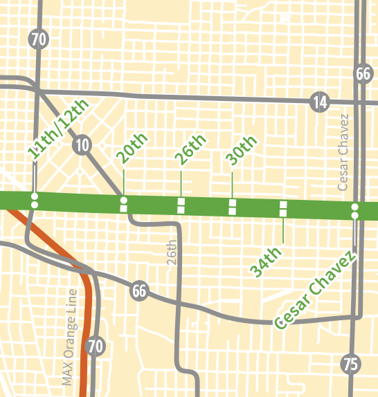
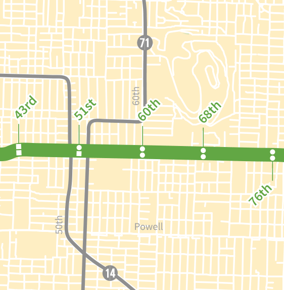
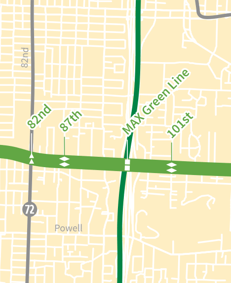
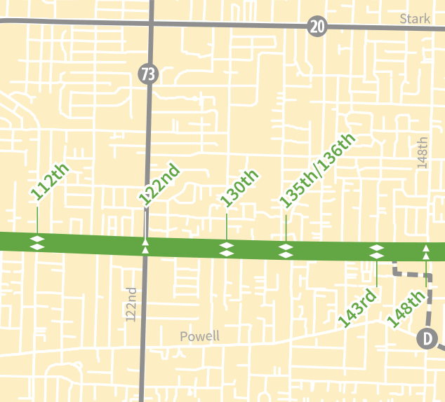
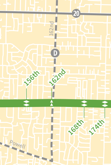
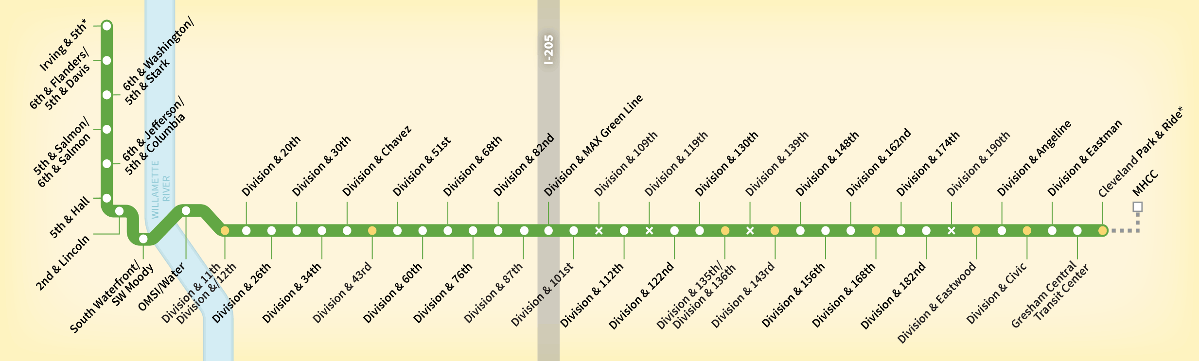
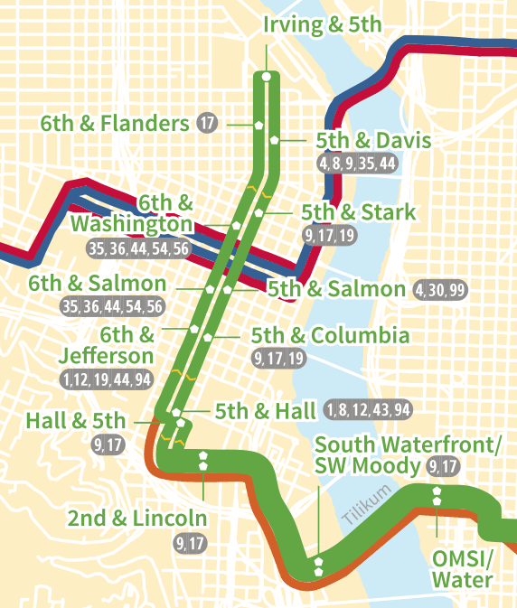
Project Route and Stations

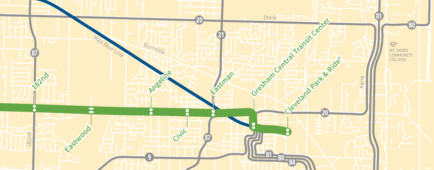
This map shows the proposed route and station locations resulting from project design that began in January 2017.

Drag map to scroll

Division Transit Project alignment

Line 20 service to Mt. Hood Community College

Single-platform station

Approximate station location
(in pairs, with one platform in each direction)

Revised station location

Removed station

Design Considerations

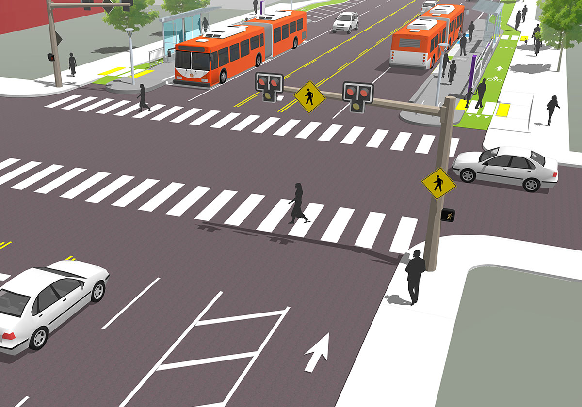
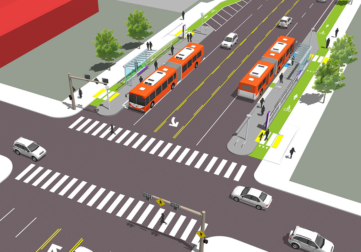
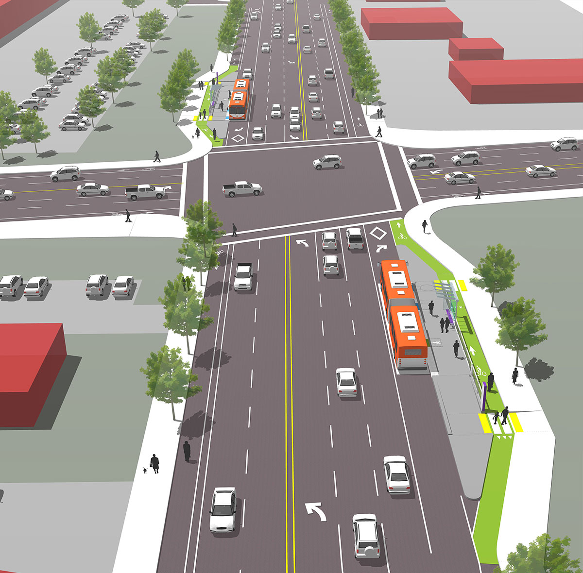
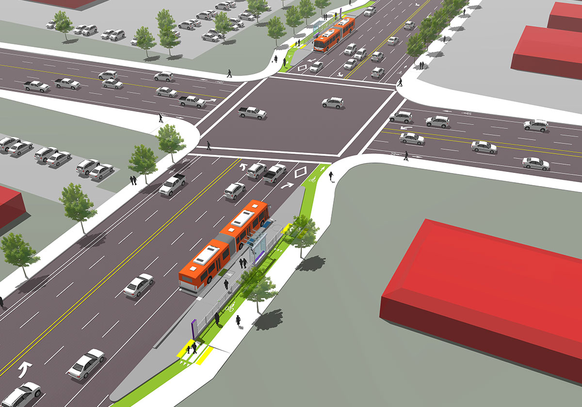
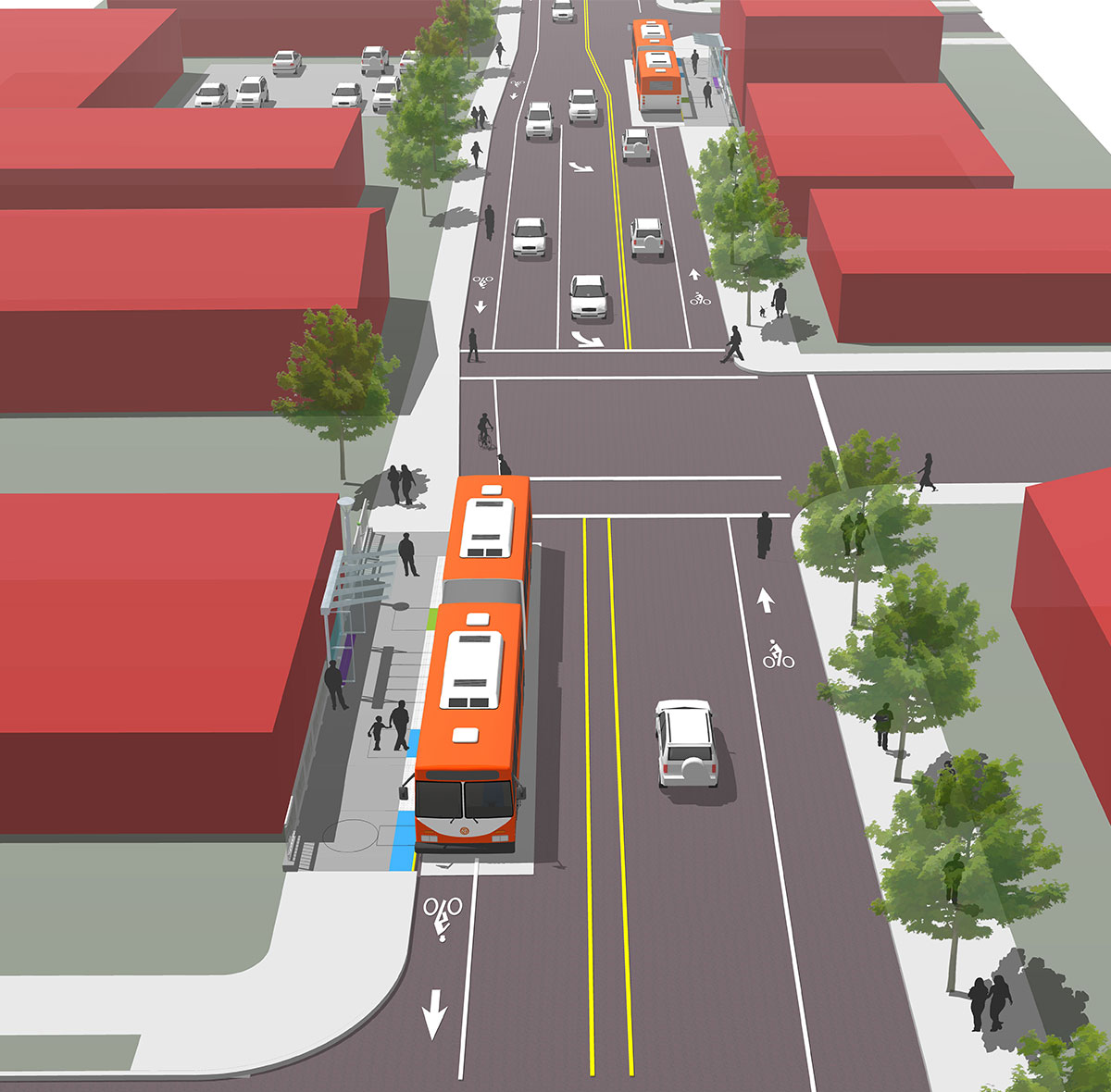
When reviewing station locations, it is important to keep in mind the factors the project’s design team is taking into consideration as their work progresses:

  • Improved safety for all Division Street users
  • Improving travel times through Transit Signal Priority
  • Preserving access to existing businesses and residences when possible
  • An average of 1/3 mile between stations
  • The different connections that exist to and from Division Street for transit riders, bicyclists, pedestrians and drivers
  • Avoiding relocation of gas pipes, sewer lines or major utility poles
  • Bus stops for 60-foot articulated buses
  • New station platforms will allow all-door level boarding of buses
  • Locating stops past traffic signals

Top

Geographic Areas

These maps focus on seven sections of the project route. Click each segment to see a map.


Segment 1: Downtown

Irving & 5th Ave to 8th Ave (most stations in this segment already exist)

Segment 1: Downtown

Division Transit Project alignment

Bus connections

MAX light rail

Existing station

Integrated 2 station type Details


Segment 2: Inner Division

8th Ave to Cesar Chavez Blvd

Segment 2: Inner Division

Division Transit Project alignment

Bus connections

MAX light rail

Integrated 1 station type Details

Integrated 2 station type Details


Segment 3: Middle Division

Cesar Chavez Blvd to 78th Ave

Segment 3: Middle Division

Division Transit Project alignment

Bus connections

Integrated 1 station type Details

Integrated 2 station type Details


Segment 4: Jade District

78th Ave to 109th Ave

Segment 4: Jade District

Division Transit Project alignment

Bus connections

MAX light rail

Island 1 station type Details

Island 2 station type Details

Integrated 1 station type Details


Segment 5: Division Midway

109th Ave to 148th Ave

Segment 5: Division Midway

Division Transit Project alignment

Bus connections

Future bus connection

Island 1 station type Details

Island 2 station type Details


Segment 6: Outer Division

148th Ave to 174th Ave

Segment 6: Outer Division

Division Transit Project alignment

Bus connections

Future bus connection

Island 1 station type Details

Island 2 station type Details


Segment 7: Gresham

174th Ave to Gresham Central Transit Center

Drag map to scroll

Segment 7: Gresham

Division Transit Project alignment

Bus connections

MAX light rail

Island 1 station type

Integrated 1 station type

Integrated 2 station type

Top

Station Types

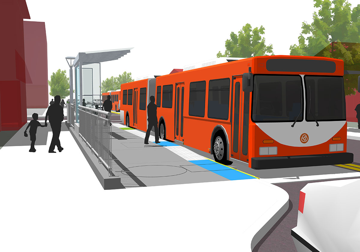
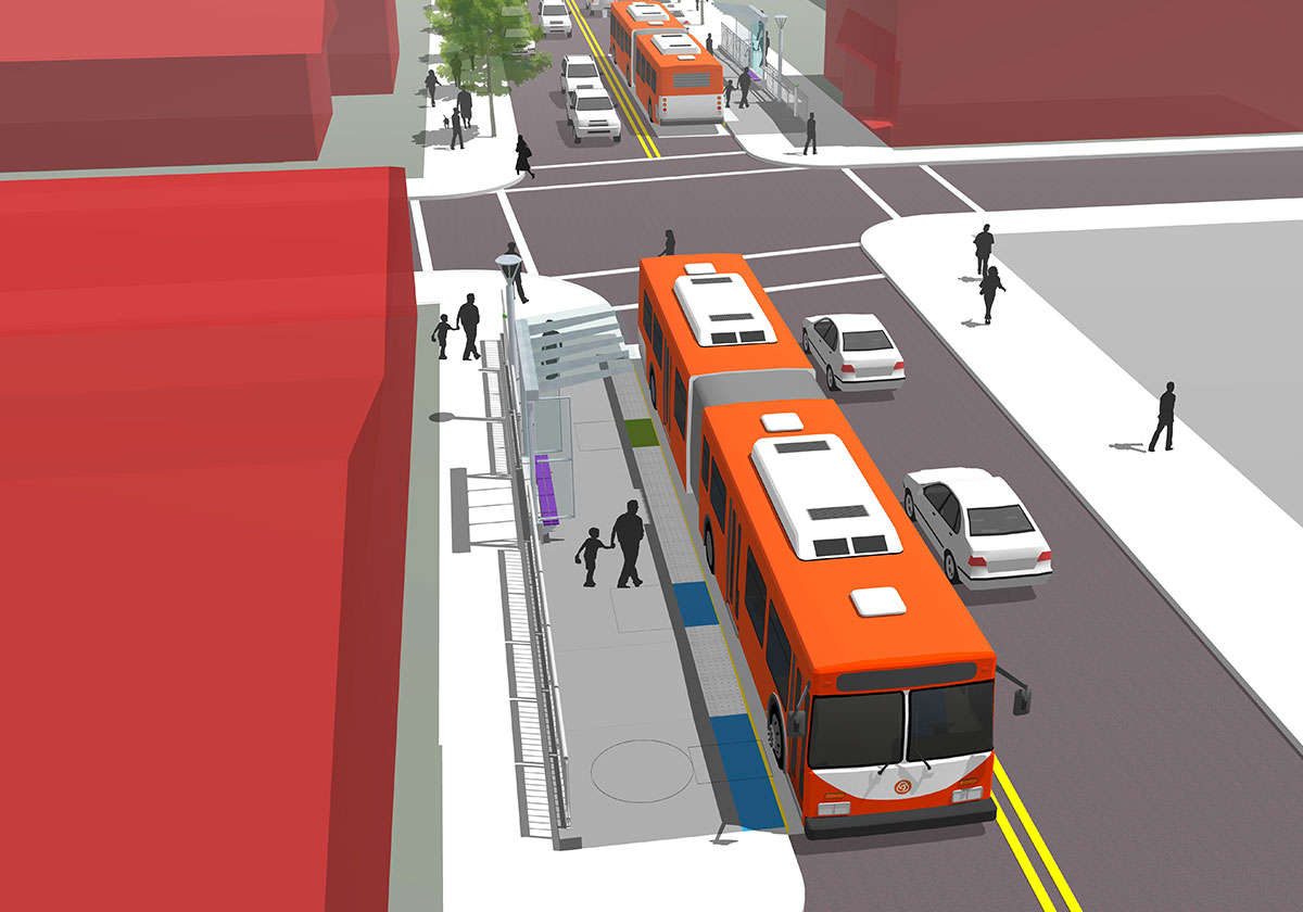
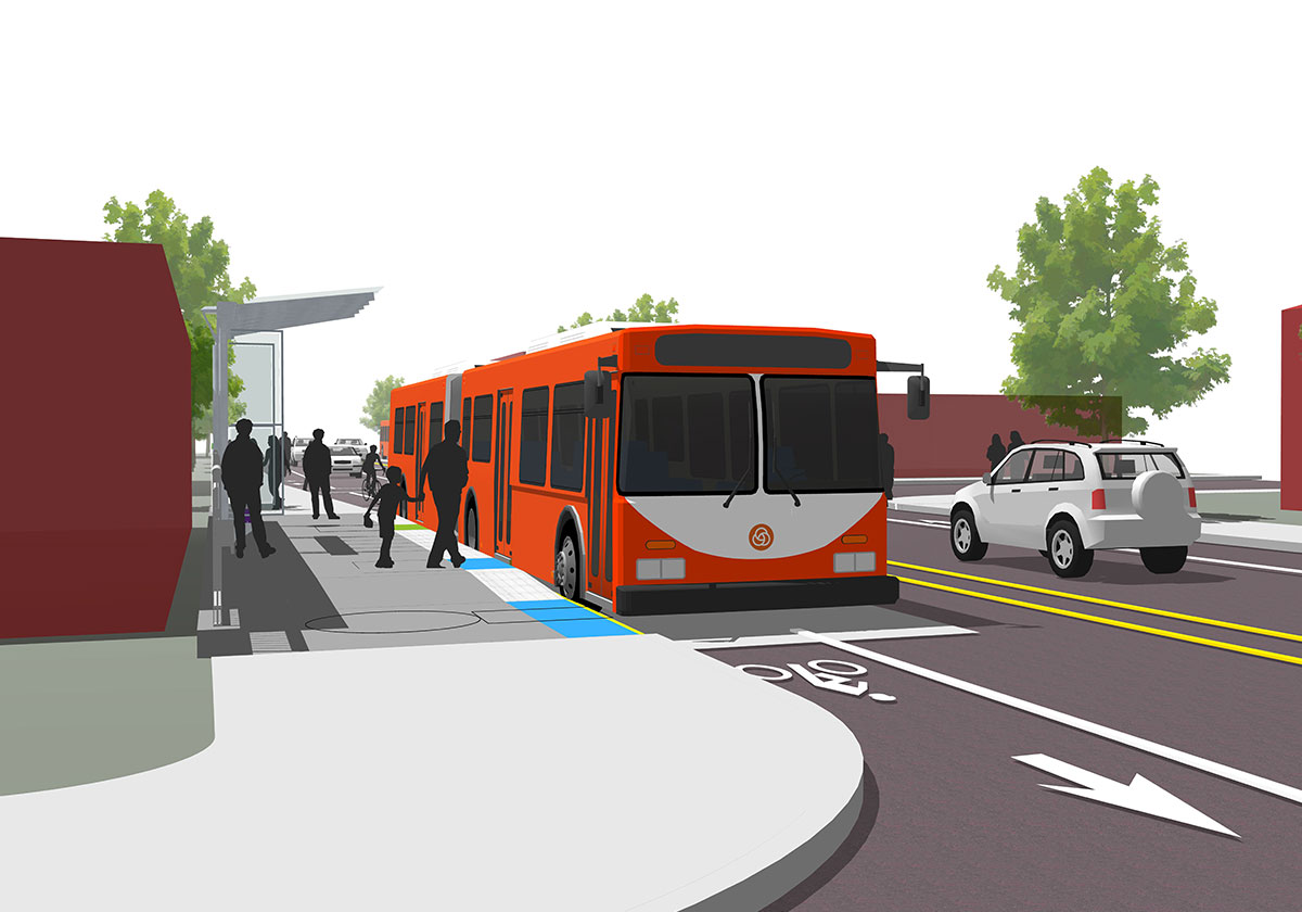
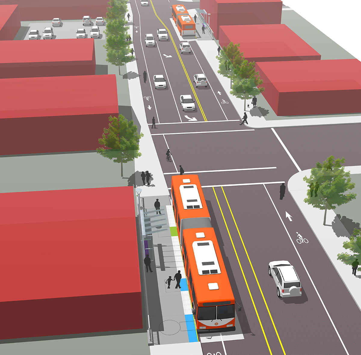
These four station types are proposed for construction throughout the project based on the appropriate type for the right location.


Island 1

  • Typically located away from major intersections
  • Located in proximity to signalized crossings (existing or proposed)
  • Bike lane located between platform and sidewalk
  • Typically accomplished by tapering travel and bike lanes without widening the street
  • Located primarily in Jade, Division Midway and Outer Division segments
Island 1 A Island 1 B Island 1 C


Island 2

  • Located at near or far side of arterial to arterial intersections
  • Proximity to north/south transit transfer locations now or in the future
  • Bike lane located between platform and sidewalk
  • Feasible only with wider than existing curb-to-curb street widths
  • Street cross section is widened for bus pull out, and/or Business Access and Transit (BAT) lanes on approach to the intersection
  • Property acquisition may be required
  • Bus stops either in a pull out on the far side of the intersection or in a BAT lane on the near side
  • Located in Jade, Division Midway and Outer Division segments
Island 2 A Island 2 B Island 2 C


Integrated 1

  • Located where right-of-way is narrower
  • Located in proximity to signalized crossings (existing or proposed)
  • Bike lanes (if present) remain on-street and pass in front of the platform
  • Platform is adjacent to sidewalk but slightly higher
  • Shelter and railings define the back edge of the platform along the sidewalk
  • Located primarily in Inner Division, Middle Division and Gresham segments
Integrated 1 A Integrated 1 B Integrated 1 C


Integrated 2

  • Located where right-of-way is narrow with building at property line
  • Located in proximity to signalized crossings (existing or proposed)
  • Bike lanes (if present) remain on-street and pass in front of the platform
  • Platform and sidewalk are combined–and lifted up to new height
  • Some locations may require modified shelter orientation
  • Located primarily in Downtown Portland, Inner Division, Middle Division and Gresham segments
Integrated 2 A Integrated 2 B Integrated 2 C

Top

Project Schedule

Planning

Design

2014

2015

2016

2017


Design 

Service begins

2018

2019

2020

2021

Construction


Top