Neighborhood Access Diagrams
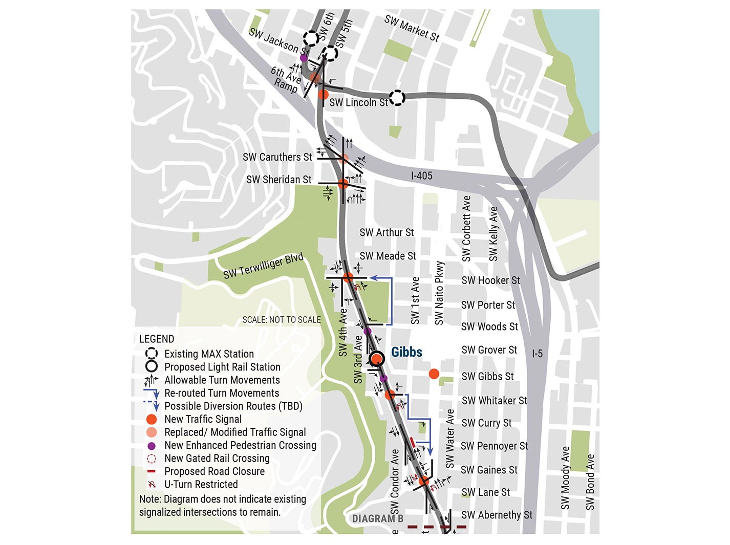
Downtown Portland and Gibbs Station areas
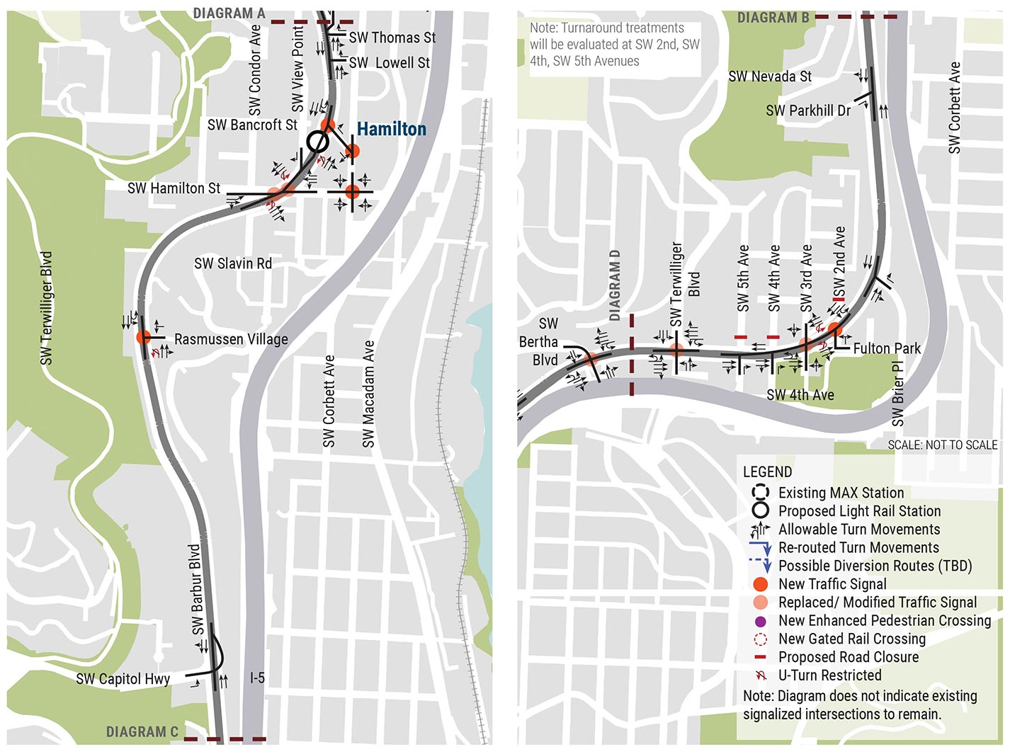
Hamilton Station area

Custer Station, 19th Station and 30th Station areas
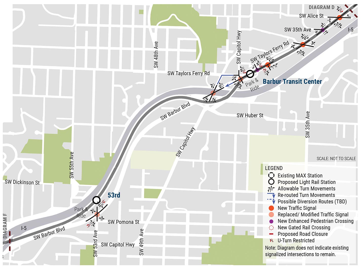
Barbur Transit Center and 53rd Station areas

68th Station and Elmhurst Station area
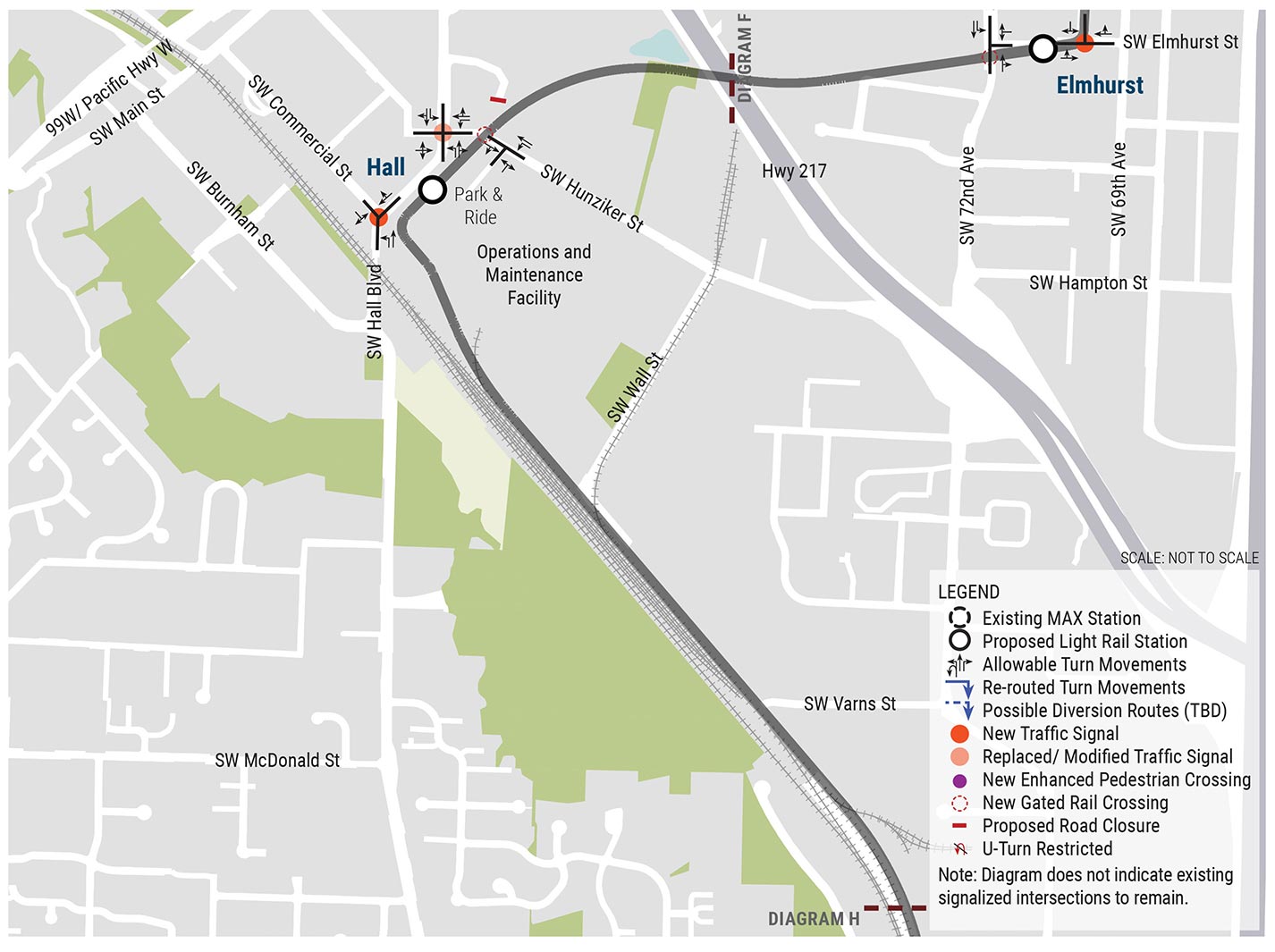
Elmhurst Station and Hall Station areas
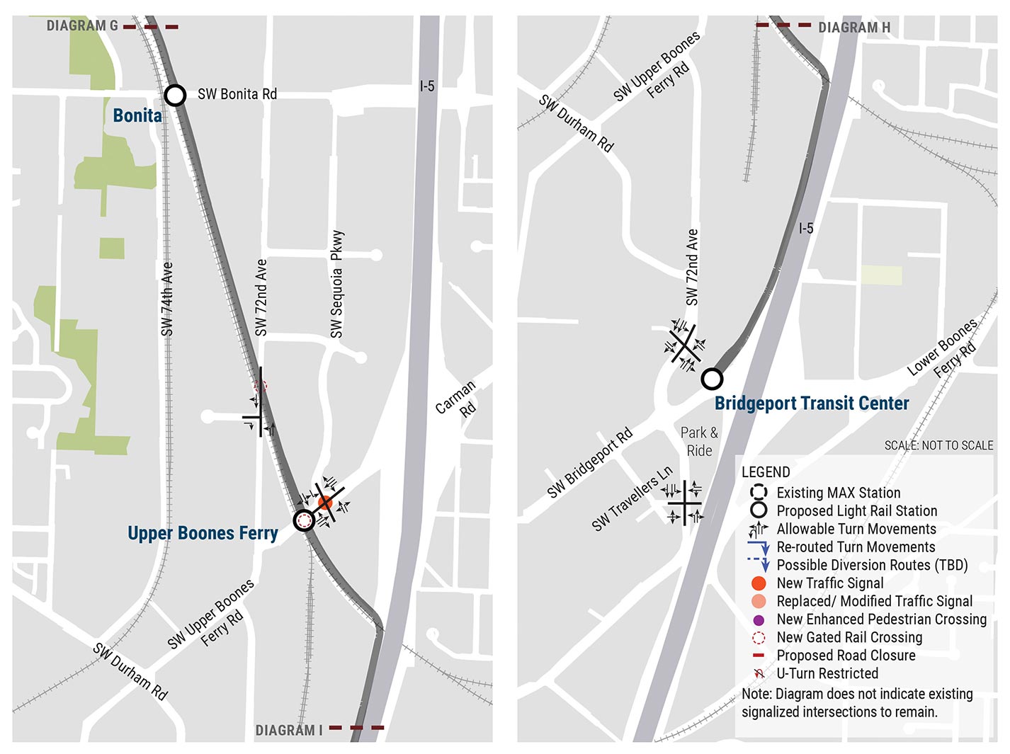
Bonita Station, Upper Boones Ferry Station and Bridgeport Transit Center areas
Comments or questions?
Call 503-962-2150 or email for more information.